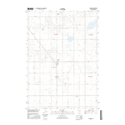
2016 Map of Waldorf
USGS Topo · Published 2016About this map
Waldorf serves as the central hub of this Waseca County landscape, situated where the grid of county roads and local streets like Main St and Railway St converge. The surrounding territory is defined by its agricultural character and an extensive drainage network, including the meandering Little Cobb River and the engineered path of Judicial Ditch Number Fiftyone. For those researching local heritage, the map is remarkably dense with burial sites, showing numerous family and congregational landmarks such as Vivian Cem, Zoars Cem, and Radloff Cem. These sites, along with the Freedom Lutheran Church Cem and First Lutheran Church Cem, indicate the deep-rooted community history and the various denominations that settled this part of southern Minnesota. The terrain is further shaped by Bull Run Cr and the presence of Silver Lake in the northeast, illustrating the post-glacial topography of the region.
Find a feature on this map
49 named features on this map. Tap any name to fly to it.
Don’t see what you’re looking for? This feature index may not catch every label — zoom into the map to look around manually.
Map Details
Editions of this 2016 Waldorf Map
This is the sole edition of this map. No revisions or reprints were ever made.
Other maps of this area

1950 · Mankato East
USGS Topo · 1:62,500

1951 · Mankato East
USGS Topo · 1:62,500

1953 · Saint Paul
USGS Topo · 1:250,000

1954 · Mason City
USGS Topo · 1:250,000

1957 · Mason City
USGS Topo · 1:250,000

1958 · Mason City
USGS Topo · 1:250,000

1959 · Saint Paul
USGS Topo · 1:250,000

1966 · Waseca
USGS Topo · 1:24,000

1966 · Janesville
USGS Topo · 1:24,000

1967 · Minnesota Lake
USGS Topo · 1:24,000