
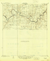
1928 Map of Waldrip
USGS Topo · Published 1928About this map
The Colorado River carves a winding path along the boundary between Coleman and McCulloch Counties, serving as the primary geographic anchor for this central Texas landscape. In the mid-1920s, river crossings were critical nodes for local travel, as evidenced by the namesake Chaffin Crossing near the small settlement of Waldrip and the strategic Military Crossing further east. These points indicate a rural economy tied to the river's seasonal flow and established fords before modern bridging became widespread.
Find a feature on this map
29 named features on this map. Tap any name to fly to it.
Don’t see what you’re looking for? This feature index may not catch every label — zoom into the map to look around manually.
Map Details
Editions of this 1928 Waldrip Map
2 editions found
Other maps of this area

1887 · Coleman
USGS Topo · 1:125,000

1889 · Coleman
USGS Topo · 1:125,000

1892 · Eden
USGS Topo · 1:125,000

1892 · Ballinger
USGS Topo · 1:125,000

1894 · Brady
USGS Topo · 1:125,000

1896 · Eden
USGS Topo · 1:125,000

1924 · Eden 1-a
USGS Topo · 1:48,000

1924 · Brady 2-a
USGS Topo · 1:48,000

1925 · Brady 2-b
USGS Topo · 1:48,000

1925 · Brady 1-b
USGS Topo · 1:48,000