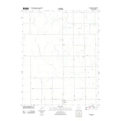
2012 Map of Waldron
USGS Topo · Published 2012About this map
Waldron sits in the southern portion of this landscape, its street grid defined by Main St, Krider, and Edwards St. The area's agricultural character is mapped through a rigid section-line road network, including SW 100 Rd and SW 80 Ave, which cuts across the natural winding paths of Sandy Cr and Plum Cr. These waterways create the only irregular breaks in the prairie topography, occasionally gathering near small clusters like Ruella or the northern hamlet of Shook.
Find a feature on this map
26 named features on this map. Tap any name to fly to it.
Don’t see what you’re looking for? This feature index may not catch every label — zoom into the map to look around manually.
Map Details
Editions of this 2012 Waldron Map
This is the sole edition of this map. No revisions or reprints were ever made.
Other maps of this area

1889 · Anthony
USGS Topo · 1:125,000

1891 · Anthony
USGS Topo · 1:125,000

1955 · Woodward
USGS Topo · 1:250,000

1955 · Pratt
USGS Topo · 1:250,000

1958 · Woodward
USGS Topo · 1:250,000

1959 · Pratt
USGS Topo · 1:250,000

1969 · Amorita
USGS Topo · 1:24,000
1969 · Manchester
USGS Topo · 1:24,000
1969 · Manchester NW
USGS Topo · 1:24,000

1972 · Attica
USGS Topo · 1:24,000