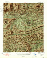
1949 Map of Waldron
USGS Topo · Published 1949About this map
Waldron serves as the central hub of this Scott County landscape, surveyed in the late 1930s when the Kansas City Southern railroad was the primary artery for transportation and trade through the Poteau Mountain region. The settlement pattern reveals a deeply rural network of small community schools and churches, such as Evening Shade Sch, Old Salem Sch, and Birdview Ch, many of which were tied to the timber and farming economies of the Quachita National Forest.
Find a feature on this map
89 named features on this map. Tap any name to fly to it.
Don’t see what you’re looking for? This feature index may not catch every label — zoom into the map to look around manually.
Map Details
Editions of this 1949 Waldron Map
2 editions found

Other maps of this area

1879 · Poteau Mountain
USGS Topo · 1:62,500

1887 · Poteau Mountain #1
USGS Topo · 1:62,500

1887 · Mount Ida #2
USGS Topo · 1:62,500

1887 · Magazine Mountain #3
USGS Topo · 1:62,500

1887 · Magazine Mountain
USGS Topo · 1:62,500

1887 · Poteau Mountain #2
USGS Topo · 1:62,500

1887 · Greenwood
USGS Topo · 1:62,500

1890 · Magazine Mountain
USGS Topo · 1:125,000

1890 · Mount Ida
USGS Topo · 1:125,000

1890 · Fort Smith
USGS Topo · 1:125,000