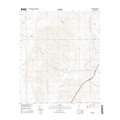
2015 Map of Waldrup
USGS Topo · Published 2015About this map
Waldrup and the surrounding woodlands of Jasper County are defined by a complex network of creeks that once shaped the settlement patterns of this Mississippi region. In this mid-2010s landscape, the waters of Tallahala Cr and Bogue Ealiah wind through the western reaches, while Tallahattah Cr dominates the central and eastern sections. For genealogists and local historians, the map preserves the location of Pisgah Cem and Philadelphia Cem, which serve as quiet markers of the community's ancestral roots near the small settlement of Kelona. The road network, including Old Bay Springs Rd, follows the higher ground between the drainages of Bogue Homo and Prairie Cr. This survey illustrates the persistent rural character of the area, where land divisions and drainage basins continue to dictate the placement of homes and local thoroughfares.
Find a feature on this map
52 named features on this map. Tap any name to fly to it.
Don’t see what you’re looking for? This feature index may not catch every label — zoom into the map to look around manually.
Map Details
Editions of this 2015 Waldrup Map
This is the sole edition of this map. No revisions or reprints were ever made.
Other maps of this area

1953 · Hattiesburg
USGS Topo · 1:250,000

1953 · Meridian
USGS Topo · 1:250,000

1957 · Meridian
USGS Topo · 1:250,000

1957 · Enterprise
USGS Topo · 1:62,500

1958 · Hattiesburg
USGS Topo · 1:250,000

1963 · Waldrup
USGS Topo · 1:24,000

1963 · Heidelberg
USGS Topo · 1:24,000

1964 · Heidelberg SW
USGS Topo · 1:24,000

1964 · Moss
USGS Topo · 1:24,000

1964 · Sandersville
USGS Topo · 1:24,000