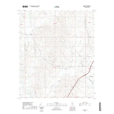
2018 Map of Waldrup
USGS Topo · Published 2018About this map
The town of Heidelberg anchors the southeastern corner of this Jasper County landscape, situated where the terrain begins to slope toward the drainage of Bogue Homo. To the northwest, the smaller settlement of Waldrup sits along Co RD 31, illustrating the region's network of rural corridors and timbered tracts. The area is defined by an intricate web of waterways, including the winding course of Tallahala Cr and the extensive reaches of Bogue Ealiah, which dominate the central and western portions of the quadrangle.
Find a feature on this map
48 named features on this map. Tap any name to fly to it.
Don’t see what you’re looking for? This feature index may not catch every label — zoom into the map to look around manually.
Map Details
Editions of this 2018 Waldrup Map
This is the sole edition of this map. No revisions or reprints were ever made.
Other maps of this area

1953 · Hattiesburg
USGS Topo · 1:250,000

1953 · Meridian
USGS Topo · 1:250,000

1957 · Meridian
USGS Topo · 1:250,000

1957 · Enterprise
USGS Topo · 1:62,500

1958 · Hattiesburg
USGS Topo · 1:250,000

1963 · Waldrup
USGS Topo · 1:24,000

1963 · Heidelberg
USGS Topo · 1:24,000

1964 · Heidelberg SW
USGS Topo · 1:24,000

1964 · Moss
USGS Topo · 1:24,000

1964 · Sandersville
USGS Topo · 1:24,000