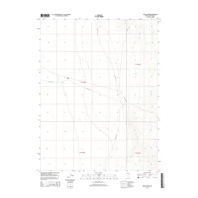
2014 Map of Waldy Pond
USGS Topo · Published 2014About this map
Jakes Valley dominates this high-elevation landscape in White Pine County, showing the intersection of historic transit corridors and vital water sources. The namesake Waldy Pond and the seasonal flow of Illipah Cr provide the primary water features in an area defined by wide alluvial basins and rising mountain slopes. This 2014 survey documents the enduring path of the Old Lincoln Hwy, a route of significant importance to early transcontinental travel in the American West. The alignment of Jakes Wash Rd further illustrates the established network of desert roads that connect this remote basin to the broader regional infrastructure. The map provides a clear record of the public land survey system, with township and range lines like t17n r60e and t16n r61e delineating the vast open spaces of the Great Basin.
Find a feature on this map
9 named features on this map. Tap any name to fly to it.
Don’t see what you’re looking for? This feature index may not catch every label — zoom into the map to look around manually.
Map Details
Editions of this 2014 Waldy Pond Map
This is the sole edition of this map. No revisions or reprints were ever made.
Other maps of this area

1949 · Treasure Hill
USGS Topo · 1:62,500

1950 · Treasure Hill
USGS Topo · 1:62,500

1951 · Illipah
USGS Topo · 1:62,500

1956 · Ely
USGS Topo · 1:250,000

1958 · Reipetown
USGS Topo · 1:24,000

1958 · Giroux Wash
USGS Topo · 1:24,000

1959 · Ely
USGS Topo · 1:250,000

1959 · Reipetown
USGS Topo · 1:62,500

1959 · Preston Reservoir
USGS Topo · 1:62,500

1963 · Ely
USGS Topo · 1:250,000