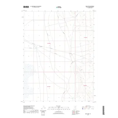
2018 Map of Waldy Pond
USGS Topo · Published 2018About this map
Jakes Valley dominates this high-altitude basin in eastern Nevada, where the drainage of Illipah Cr feeds into the namesake Waldy Pond. The terrain reflects the transition from open valley floor to the rising ridges that define the Great Basin landscape. A primary historical corridor is preserved here via the Old Lincoln Hwy, which cuts across the central portion of the sheet. This route traces the legacy of America's first transcontinental automobile road, providing a specific geographic record of its path before modern realignments. Branching from this main artery, Jakes Wash Rd provides access to the surrounding rangeland. The map detail highlights the sparse but critical water resources in an arid environment, where small features like the pond and creek dictated the movement and settlement patterns of early travelers and ranchers.
Find a feature on this map
9 named features on this map. Tap any name to fly to it.
Don’t see what you’re looking for? This feature index may not catch every label — zoom into the map to look around manually.
Map Details
Editions of this 2018 Waldy Pond Map
This is the sole edition of this map. No revisions or reprints were ever made.
Other maps of this area

1949 · Treasure Hill
USGS Topo · 1:62,500

1950 · Treasure Hill
USGS Topo · 1:62,500

1951 · Illipah
USGS Topo · 1:62,500

1956 · Ely
USGS Topo · 1:250,000

1958 · Reipetown
USGS Topo · 1:24,000

1958 · Giroux Wash
USGS Topo · 1:24,000

1959 · Ely
USGS Topo · 1:250,000

1959 · Reipetown
USGS Topo · 1:62,500

1959 · Preston Reservoir
USGS Topo · 1:62,500

1963 · Ely
USGS Topo · 1:250,000