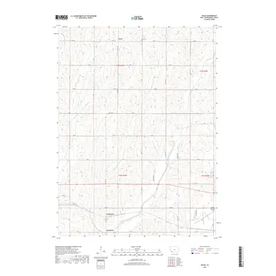
2018 Map of Wales
USGS Topo · Published 2018About this map
The rural landscape of Montgomery County centers on the small unincorporated settlement of Wales, where local history is anchored by the Gomer Cem to the east. This section of southwestern Iowa is defined by a rhythmic series of north-south drainage basins, including the branching waters of Indian Cr, Little Indian Cr, and Crabapple Cr. These waterways dictate the subtle rise and fall of the terrain between the rigid grid of county roads like 130th St and 180 St.
Find a feature on this map
28 named features on this map. Tap any name to fly to it.
Don’t see what you’re looking for? This feature index may not catch every label — zoom into the map to look around manually.
Map Details
Editions of this 2018 Wales Map
This is the sole edition of this map. No revisions or reprints were ever made.
Other maps of this area

1954 · Omaha
USGS Topo · 1:250,000

1955 · Nebraska City
USGS Topo · 1:250,000

1957 · Nebraska City
USGS Topo · 1:250,000

1957 · Omaha
USGS Topo · 1:250,000

1958 · Omaha
USGS Topo · 1:250,000

1958 · Nebraska City
USGS Topo · 1:250,000

1978 · Carson
USGS Topo · 1:24,000

1978 · Griswold
USGS Topo · 1:24,000
1978 · Emerson
USGS Topo · 1:24,000

1978 · Wales
USGS Topo · 1:24,000