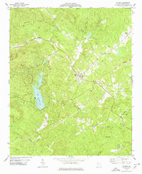
1974 Map of Waleska
USGS Topo · Published 1977About this map
Waleska and the campus of Reinhardt College anchor this survey of northwestern Cherokee County, conducted in the mid-1970s. The landscape is defined by the sharp rise of Pine Log Mountain and Garland Mountain to the northwest, transitioning into the sprawling waters of Lake Arrowhead. The area's social fabric is reflected in a dense network of rural congregations and burial grounds, including Pleasant Arbor Ch, Olive Vine Ch, and New Friendship Ch.
Find a feature on this map
47 named features on this map. Tap any name to fly to it.
Don’t see what you’re looking for? This feature index may not catch every label — zoom into the map to look around manually.
Map Details
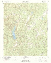
Editions of this 1974 Waleska Map
2 editions found
Other maps of this area

1890 · Suwanee
USGS Topo · 1:125,000

1890 · Cartersville
USGS Topo · 1:125,000

1891 · Cartersville
USGS Topo · 1:125,000

1894 · Suwanee
USGS Topo · 1:125,000

1896 · Cartersville
USGS Topo · 1:125,000

1907 · Acworth
USGS Topo · 1:62,500

1909 · Acworth
USGS Topo · 1:62,500

1926 · Tate
USGS Topo · 1:62,500

1928 · Tate
USGS Topo · 1:62,500

1947 · Waleska
USGS Topo · 1:62,500