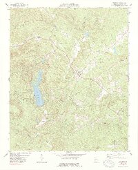
1974 Map of Waleska
USGS Topo · Published 1989About this map
Waleska and the campus of Reinhardt College form the cultural center of this Northwest Georgia landscape as it appeared in the mid-1970s. The area is defined by the significant presence of Lake Arrowhead, which dominates the western topography near the slopes of Pine Log Mountain. The map reveals a deeply rooted community structure, evidenced by a high density of country churches and associated cemeteries, including Mt Zion Ch, Sardis Ch, and New Friendship Ch. This period shows a transition from traditional rural patterns toward recreational development, with the established Moore Sch and local family landmarks like Beaver Patch and Beasley Gap coexisting alongside newer features such as a Landing Strip and the expansive reservoir. Numerous watercourses, such as Byrd Creek and Shoal Creek, drain the ridges of Garland Mountain and Polecat Mtn.
Find a feature on this map
44 named features on this map. Tap any name to fly to it.
Don’t see what you’re looking for? This feature index may not catch every label — zoom into the map to look around manually.
Map Details
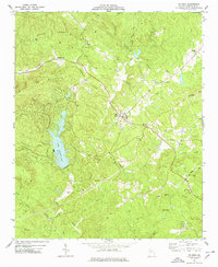
Editions of this 1974 Waleska Map
2 editions found
Other maps of this area

1890 · Suwanee
USGS Topo · 1:125,000

1890 · Cartersville
USGS Topo · 1:125,000

1891 · Cartersville
USGS Topo · 1:125,000

1894 · Suwanee
USGS Topo · 1:125,000

1896 · Cartersville
USGS Topo · 1:125,000

1907 · Acworth
USGS Topo · 1:62,500

1909 · Acworth
USGS Topo · 1:62,500

1926 · Tate
USGS Topo · 1:62,500

1928 · Tate
USGS Topo · 1:62,500

1947 · Waleska
USGS Topo · 1:62,500