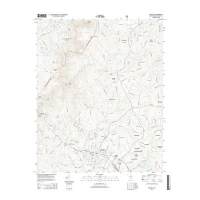
2014 Map of Walhalla
USGS Topo · Published 2014About this map
Sumter National Forest dominates the western topography of this Oconee County area, characterized by significant landmarks like Stumphouse Mtn and Tamassee Knob. The southern portion of the map reveals the urban footprint of Walhalla, showing a high concentration of civic and memorial sites such as Westview Cem, Lutheran Cem, and Evergreen Memorial Gardens. This region serves as a gateway to the mountains, where the Blue Ridge foothills meet established settlements.
Find a feature on this map
52 named features on this map. Tap any name to fly to it.
Don’t see what you’re looking for? This feature index may not catch every label — zoom into the map to look around manually.
Map Details
Editions of this 2014 Walhalla Map
This is the sole edition of this map. No revisions or reprints were ever made.
Other maps of this area

1886 · Walhalla
USGS Topo · 1:125,000

1888 · Pickens
USGS Topo · 1:125,000

1892 · Walhalla
USGS Topo · 1:125,000

1894 · Pickens
USGS Topo · 1:125,000

1896 · Walhalla
USGS Topo · 1:125,000

1954 · Greenville
USGS Topo · 1:250,000

1958 · Greenville
USGS Topo · 1:250,000

1958 · Seneca
USGS Topo · 1:24,000

1959 · Salem
USGS Topo · 1:24,000
1959 · Walhalla
USGS Topo · 1:24,000