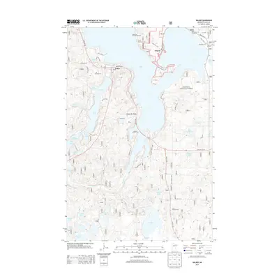
2013 Map of Walker
USGS Topo · Published 2013About this map
Walker serves as a focal point on the western shores of Leech Lake, where the landscape is defined by the intricate relationship between water and timber within the Chippewa National Forest. The settlement pattern here includes the community of Onigum on the Agency Bay peninsula and the historic Ah-gwah-ching area, reflecting the region's cultural depth and institutional history.
Find a feature on this map
71 named features on this map. Tap any name to fly to it.
Don’t see what you’re looking for? This feature index may not catch every label — zoom into the map to look around manually.
Map Details
Editions of this 2013 Walker Map
This is the sole edition of this map. No revisions or reprints were ever made.
Other maps of this area

1953 · Brainerd
USGS Topo · 1:250,000

1954 · Bemidji
USGS Topo · 1:250,000

1957 · Brainerd
USGS Topo · 1:250,000

1957 · Bemidji
USGS Topo · 1:250,000

1958 · Bemidji
USGS Topo · 1:250,000

1958 · Brainerd
USGS Topo · 1:250,000

1965 · Brainerd
USGS Topo · 1:250,000

1970 · Hackensack
USGS Topo · 1:24,000

1970 · Webb Lake
USGS Topo · 1:24,000
1970 · Crystal Lake
USGS Topo · 1:24,000