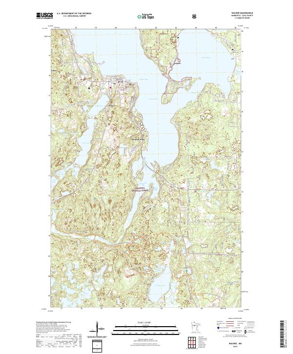
2022 Map of Walker
USGS Topo · Published 2022About this map
Walker serves as the focal point of this northern Minnesota landscape, situated prominently along the western shores of Walker Bay on Leech Lake. The town's civic importance is marked by the Cass County Courthouse, while its local history is preserved at Evergreen Cem. Across the water, the settlement of Onigum occupies the peninsula near Pagan Cem, illustrating the distributed nature of communities around these interconnected bays. Much of the surrounding area is protected within the Chippewa National Forest, where the terrain is defined by a dense network of water bodies including Lake May, Long Lake, and Portage Lake. The map reveals a transition from the established street grids of Walker to the recreational and conservation lands to the south, where the North Country National Scenic Trl follows the winding course of the Shingobee River and the shores of Shingobee Bay.
Find a feature on this map
93 named features on this map. Tap any name to fly to it.
Don’t see what you’re looking for? This feature index may not catch every label — zoom into the map to look around manually.
Map Details
Editions of this 2022 Walker Map
This is the sole edition of this map. No revisions or reprints were ever made.
Other maps of this area

1953 · Brainerd
USGS Topo · 1:250,000

1954 · Bemidji
USGS Topo · 1:250,000

1957 · Brainerd
USGS Topo · 1:250,000

1957 · Bemidji
USGS Topo · 1:250,000

1958 · Bemidji
USGS Topo · 1:250,000

1958 · Brainerd
USGS Topo · 1:250,000

1965 · Brainerd
USGS Topo · 1:250,000

1970 · Hackensack
USGS Topo · 1:24,000

1970 · Webb Lake
USGS Topo · 1:24,000
1970 · Crystal Lake
USGS Topo · 1:24,000