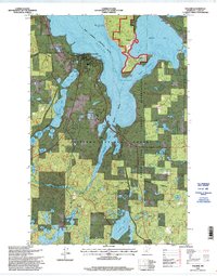
1996 Map of Walker
USGS Topo · Published 1998About this map
Walker and the historic settlement of Onigum anchor this detailed study of the southwestern shores of Leech Lake in the mid-1990s. The landscape is defined by the complex aquatic network of Agency Bay, Shingobee Bay, and Lake May, all contained within the Leech Lake Indian Reservation and the Chippewa National Forest. This era shows a community balanced between public service and recreation, featuring the Ah-gwah-ching State Nursing Home and the developed Walker City Park.
Find a feature on this map
35 named features on this map. Tap any name to fly to it.
Don’t see what you’re looking for? This feature index may not catch every label — zoom into the map to look around manually.
Map Details
Editions of this 1996 Walker Map
This is the sole edition of this map. No revisions or reprints were ever made.
Other maps of this area

1953 · Brainerd
USGS Topo · 1:250,000

1954 · Bemidji
USGS Topo · 1:250,000

1957 · Brainerd
USGS Topo · 1:250,000

1957 · Bemidji
USGS Topo · 1:250,000

1958 · Bemidji
USGS Topo · 1:250,000

1958 · Brainerd
USGS Topo · 1:250,000

1965 · Brainerd
USGS Topo · 1:250,000

1970 · Hackensack
USGS Topo · 1:24,000

1970 · Webb Lake
USGS Topo · 1:24,000
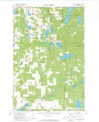
1970 · Crystal Lake
USGS Topo · 1:24,000