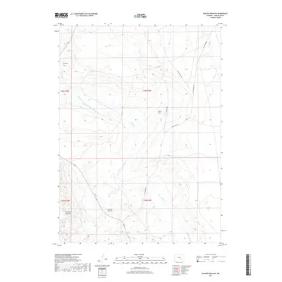
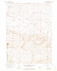
2017 Map of Walker Draw NW
USGS Topo · Published 2017About this map
The Freezeout Mountains dominate the southwestern corner of this Carbon County landscape, giving way to a complex system of drainage and irrigation. The high-desert terrain is defined by its water management, most notably the Marolf and Walker Ditch Number 1, which cuts across the central township lines to redirect flows between Muddy Cr and House Cr. This intricate network of draws, including Antelope Draw and Shearing Pen Draw, illustrates the historical reliance on seasonal water sources in this part of Wyoming. Transportation is limited to rugged tracks like Little Medicine Rd and Walker Draw 3136, which follow the natural contours of the eponymous Walker Draw. This 2017 survey by the U.S. Geological Survey captures the enduring ranching character of the land, where named features often reflect historical land use and livestock management.
Find a feature on this map
13 named features on this map. Tap any name to fly to it.
Don’t see what you’re looking for? This feature index may not catch every label — zoom into the map to look around manually.
Map Details
Editions of this 2017 Walker Draw NW Map
This is the sole edition of this map. No revisions or reprints were ever made.
Other maps of this area

1955 · Casper
USGS Topo · 1:250,000

1958 · Casper
USGS Topo · 1:250,000

1959 · Moss Agate Reservoir
USGS Topo · 1:24,000

1959 · Chalk Hills
USGS Topo · 1:24,000

1960 · Measel Spring Reservoir
USGS Topo · 1:24,000
1961 · Walker Draw SE
USGS Topo · 1:24,000

1961 · T B Ranch
USGS Topo · 1:24,000
1961 · Big Charlie Lakes
USGS Topo · 1:24,000
1961 · Windy Hill
USGS Topo · 1:24,000
1961 · Cameron Creek
USGS Topo · 1:24,000