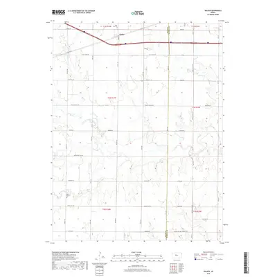
2018 Map of Walker
USGS Topo · Published 2018About this map
Walker is the primary settlement on this Central Kansas landscape, positioned along the northern transport corridor where modern infrastructure meets the heritage of the Great Plains. The map reveals a high concentration of local history markers, particularly through its cemeteries like Saint Anns Cem and Saint Boniface Cem, which suggest the lasting influence of early Catholic parish settlements in the region. The drainage patterns of Big Creek and its tributaries, including Mud Creek and N Fork Big Creek, carve through the sections of Ellis and Russell counties, dictating the placement of secondary roads. One such route, Butterfield Trail Road, preserves the nomenclature of a historic stagecoach line that once moved passengers and mail across the Kansas territory, while newer paths like Grants Villa Road and Munjor Road define the contemporary rural grid.
Find a feature on this map
33 named features on this map. Tap any name to fly to it.
Don’t see what you’re looking for? This feature index may not catch every label — zoom into the map to look around manually.
Map Details
Editions of this 2018 Walker Map
This is the sole edition of this map. No revisions or reprints were ever made.
Other maps of this area

1896 · Russell
USGS Topo · 1:125,000

1896 · Hays
USGS Topo · 1:125,000

1955 · Great Bend
USGS Topo · 1:250,000

1957 · Great Bend
USGS Topo · 1:250,000

1958 · Great Bend
USGS Topo · 1:250,000

1961 · Catharine
USGS Topo · 1:24,000
1961 · Walker
USGS Topo · 1:24,000

1961 · Russell SW
USGS Topo · 1:24,000

1961 · Victoria
USGS Topo · 1:24,000

1967 · Russell NW
USGS Topo · 1:24,000