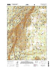
2017 Map of Walker Mountain
USGS Topo · Published 2017About this map
Walker Rim dominates this high-elevation landscape where the Deschutes National Forest and Winema National Forest meet in northern Klamath County. The area is defined by volcanic features, from the prominent heights of Walker Mtn and Marmot Butte to the lower elevation of Marmot Pass. This 2017 survey details an extensive network of forest development roads, such as Nat For Dev Rd 9760, that provide access to this isolated timberland. Hydrological points of interest include several vital water sources like South Walker Spring, Skookum Spring, and the headwaters of Jack Cr. The map also identifies Skookum Butte in the southeastern section, showing how the drainage and terrain patterns shaped early forestry and resource management in the Cascades region.
Find a feature on this map
27 named features on this map. Tap any name to fly to it.
Don’t see what you’re looking for? This feature index may not catch every label — zoom into the map to look around manually.
Map Details
Editions of this 2017 Walker Mountain Map
This is the sole edition of this map. No revisions or reprints were ever made.
Other maps of this area

1935 · Chemult
USGS Topo · 1:96,000

1941 · Chemult
USGS Topo · 1:125,000

1955 · Crescent
USGS Topo · 1:250,000

1957 · Crescent
USGS Topo · 1:250,000

1958 · Crescent
USGS Topo · 1:250,000
1967 · Chemult
USGS Topo · 1:24,000
1967 · Muttonchop Butte
USGS Topo · 1:24,000
1967 · Walker Mtn
USGS Topo · 1:24,000
1967 · Sellers Marsh
USGS Topo · 1:24,000
1967 · Odell Butte
USGS Topo · 1:24,000