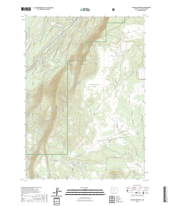
2023 Map of Walker Mountain
USGS Topo · Published 2023About this map
The Walker Rim escarpment dominates this section of the Oregon Cascades, marking a sharp geological divide within the Deschutes National Forest and Winema National Forest. This high-altitude landscape is defined by volcanic features and reliable water sources that have supported timber and range activities for generations. Significant peaks like Walker Mtn, Marmot Butte, and Skookum Butte provide prominent overlooks across the basin, while Marmot Pass serves as a natural transition point between the drainages.
Find a feature on this map
18 named features on this map. Tap any name to fly to it.
Don’t see what you’re looking for? This feature index may not catch every label — zoom into the map to look around manually.
Map Details
Editions of this 2023 Walker Mountain Map
This is the sole edition of this map. No revisions or reprints were ever made.
Other maps of this area

1935 · Chemult
USGS Topo · 1:96,000

1941 · Chemult
USGS Topo · 1:125,000

1955 · Crescent
USGS Topo · 1:250,000

1957 · Crescent
USGS Topo · 1:250,000

1958 · Crescent
USGS Topo · 1:250,000
1967 · Chemult
USGS Topo · 1:24,000
1967 · Muttonchop Butte
USGS Topo · 1:24,000
1967 · Walker Mtn
USGS Topo · 1:24,000
1967 · Sellers Marsh
USGS Topo · 1:24,000
1967 · Odell Butte
USGS Topo · 1:24,000