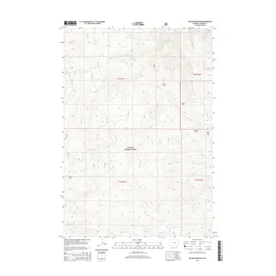
2015 Map of Walker Mountain
USGS Topo · Published 2015About this map
The Bighorn National Forest dominates this section of the Bighorn Mountains in northern Wyoming, where high-altitude drainages carve through a landscape of named peaks and high prairies. The drainage network is complex, with headwaters for Wolf Cr, Prairie Cr, and Walker Cr radiating from central ridges. A notable water management feature, Sawmill Reservoir, sits along Sawmill Cr in the southern portion of the quadrangle, reflecting the region's historical reliance on mountain snowpack for lower-elevation water needs.
Find a feature on this map
24 named features on this map. Tap any name to fly to it.
Don’t see what you’re looking for? This feature index may not catch every label — zoom into the map to look around manually.
Map Details
Editions of this 2015 Walker Mountain Map
This is the sole edition of this map. No revisions or reprints were ever made.
Other maps of this area

1895 · Dayton
USGS Topo · 1:125,000

1901 · Dayton
USGS Topo · 1:125,000

1955 · Sheridan
USGS Topo · 1:250,000

1958 · Sheridan
USGS Topo · 1:250,000

1962 · Sheridan
USGS Topo · 1:250,000

1964 · Wolf
USGS Topo · 1:24,000

1964 · Dayton South
USGS Topo · 1:24,000
1964 · Skull Ridge
USGS Topo · 1:24,000

1964 · Walker Mountain
USGS Topo · 1:24,000

1964 · Beckton
USGS Topo · 1:24,000