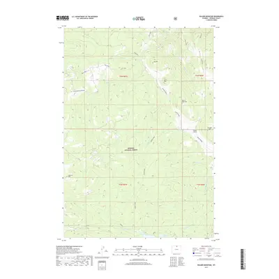
2017 Map of Walker Mountain
USGS Topo · Published 2017About this map
Bighorn National Forest dominates this high-altitude landscape in Sheridan County, defined by a complex network of drainages and prominent peaks. The southern portion of the sheet features the Sawmill Reservoir and Sawmill Lakes, which serve as a focal point for the headwaters of Sawmill Cr and the W Fork Big Goose Cr. The terrain is marked by significant elevations including Walker Mountain, Lookout Mtn, and She-Bear Mtn, illustrating the topographic prominence of the Big Horn range.
Find a feature on this map
33 named features on this map. Tap any name to fly to it.
Don’t see what you’re looking for? This feature index may not catch every label — zoom into the map to look around manually.
Map Details
Editions of this 2017 Walker Mountain Map
This is the sole edition of this map. No revisions or reprints were ever made.
Other maps of this area

1895 · Dayton
USGS Topo · 1:125,000

1901 · Dayton
USGS Topo · 1:125,000

1955 · Sheridan
USGS Topo · 1:250,000

1958 · Sheridan
USGS Topo · 1:250,000

1962 · Sheridan
USGS Topo · 1:250,000

1964 · Wolf
USGS Topo · 1:24,000

1964 · Dayton South
USGS Topo · 1:24,000
1964 · Skull Ridge
USGS Topo · 1:24,000

1964 · Walker Mountain
USGS Topo · 1:24,000

1964 · Beckton
USGS Topo · 1:24,000