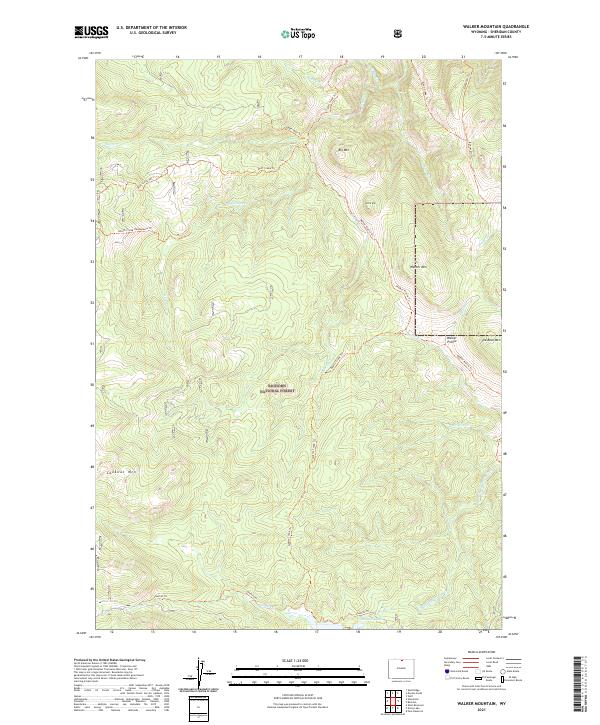
2021 Map of Walker Mountain
USGS Topo · Published 2021About this map
Bighorn National Forest dominates this high-altitude landscape in Sheridan County, defined by a complex network of ridgelines and watercourses. The topography is anchored by massive features such as Walker Mtn, Big Mtn, and She-Bear Mtn, which overlook significant drainage systems including Wolf Cr and W Fork Big Goose Cr. The map reveals a land utilized for backcountry navigation, where the Walker Prairie Trl and Roosevelt Trl provide passage through the high-country meadows of Walker Prairie. The southern reaches of the quadrangle feature the Sawmill Lakes and the accompanying Sawmill Trl, hinting at historical resource access or recreational corridors within the forest. Every stream and peak, from Gloom Cr to Lookout Mtn, illustrates the high-elevation geography of this northern Wyoming wilderness.
Find a feature on this map
32 named features on this map. Tap any name to fly to it.
Don’t see what you’re looking for? This feature index may not catch every label — zoom into the map to look around manually.
Map Details
Editions of this 2021 Walker Mountain Map
This is the sole edition of this map. No revisions or reprints were ever made.
Other maps of this area

1895 · Dayton
USGS Topo · 1:125,000

1901 · Dayton
USGS Topo · 1:125,000

1955 · Sheridan
USGS Topo · 1:250,000

1958 · Sheridan
USGS Topo · 1:250,000

1962 · Sheridan
USGS Topo · 1:250,000

1964 · Wolf
USGS Topo · 1:24,000

1964 · Dayton South
USGS Topo · 1:24,000
1964 · Skull Ridge
USGS Topo · 1:24,000

1964 · Walker Mountain
USGS Topo · 1:24,000

1964 · Beckton
USGS Topo · 1:24,000