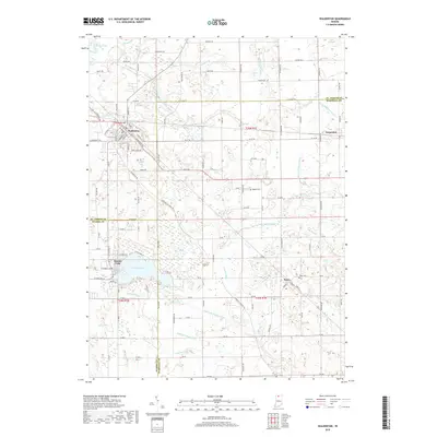
2019 Map of Walkerton
USGS Topo · Published 2019About this map
Walkerton serves as the primary hub of this landscape where St. Joseph, Marshall, and Starke counties converge. The terrain is defined by an intricate network of managed waterways, including the Angeline Lemert Ditch, Lawrence Pontius Ditch, and Jesse McKesson Ditch, which reflect the region's long history of agricultural drainage and wetland management. Settlement patterns are concentrated around the intersection of rail corridors and county lines, with the small community of Teegarden situated to the east and the recreational waters of Koontz Lake to the south. Genealogists and local historians can locate several rural landmarks, such as Barber Cem and Tyner Cem, alongside family-named water features like Peter Sarber Ditch and Sherman Emmons Ditch, which provide clues to early landownership and the modification of the northern Indiana prairie.
Find a feature on this map
112 named features on this map. Tap any name to fly to it.
Don’t see what you’re looking for? This feature index may not catch every label — zoom into the map to look around manually.
Map Details
Editions of this 2019 Walkerton Map
This is the sole edition of this map. No revisions or reprints were ever made.
Other maps of this area

1953 · Chicago
USGS Topo · 1:250,000

1957 · Chicago
USGS Topo · 1:250,000

1957 · Knox East
USGS Topo · 1:24,000

1957 · Plymouth
USGS Topo · 1:24,000

1958 · Donaldson
USGS Topo · 1:24,000

1958 · La Paz
USGS Topo · 1:24,000

1958 · Hamlet
USGS Topo · 1:24,000

1958 · Walkerton
USGS Topo · 1:24,000

1958 · Stillwell
USGS Topo · 1:24,000

1958 · North Liberty
USGS Topo · 1:24,000