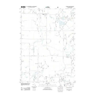
2012 Map of Walkup Lake
USGS Topo · Published 2012About this map
Walgamor Corners serves as a quiet landmark in this landscape defined by the winding course of the Big S Br Pere Marquette River. The area is characterized by an extensive network of kettle lakes and drainages, including clusters like Triple Lakes and significant water bodies such as Walkup Lake and Nichols Lake. These natural features have long made the region a destination for recreation, evidenced by the presence of the Benton Lake Recreation Area and Newaygo Recreation Area. Historically significant sites like the Beaver Lookout Tower emphasize the managed forest nature of this terrain. The map records a dense grid of rural roads, including 13 Mile Rd and 8 Mile Rd, that provide access to scattered residential pockets and established seasonal destinations like Smitty's Hideaway and Campground and Timbers Edge Campground.
Find a feature on this map
82 named features on this map. Tap any name to fly to it.
Don’t see what you’re looking for? This feature index may not catch every label — zoom into the map to look around manually.
Map Details
Editions of this 2012 Walkup Lake Map
This is the sole edition of this map. No revisions or reprints were ever made.
Other maps of this area

1931 · Walkerville NE
USGS Topo · 1:31,680

1931 · Custer SE
USGS Topo · 1:31,680

1931 · Walkerville SE
USGS Topo · 1:31,680

1954 · Milwaukee
USGS Topo · 1:250,000

1954 · Midland
USGS Topo · 1:250,000

1958 · Midland
USGS Topo · 1:250,000

1958 · Milwaukee
USGS Topo · 1:250,000

1958 · Hesperia
USGS Topo · 1:62,500

1959 · Midland
USGS Topo · 1:250,000

1959 · Baldwin
USGS Topo · 1:62,500