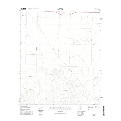
2016 Map of Wall
USGS Topo · Published 2016About this map
Wall serves as the primary settlement hub in this portion of Tom Green County, situated along the northern edge of the sheet. The landscape is defined by the ephemeral drainages of Ninemile Cr and Dry Lipan Cr, which carve through the terrain as it rises toward the southern elevations. A significant geographical marker is Lipan Spring, located in the southeastern corner, suggesting a vital historical water source for early cattle ranching and homesteading in this semi-arid region. The infrastructure is a mix of agricultural and industrial access, including roads like Walling Pecan Rd and the Marathon Oil Co Rd, which indicates the intersection of land use between traditional agriculture and modern energy extraction. Researchers can trace the layout of rural properties through an extensive network of family-named routes such as Robbie Jones Rd and Susan Peak Rd.
Find a feature on this map
22 named features on this map. Tap any name to fly to it.
Don’t see what you’re looking for? This feature index may not catch every label — zoom into the map to look around manually.
Map Details
Editions of this 2016 Wall Map
This is the sole edition of this map. No revisions or reprints were ever made.
Other maps of this area

1892 · San Angelo
USGS Topo · 1:125,000

1924 · San Angelo 2-c
USGS Topo · 1:48,000

1924 · San Angelo 2-b
USGS Topo · 1:48,000

1928 · Wall
USGS Topo · 1:62,500

1954 · San Angelo
USGS Topo · 1:250,000

1957 · Eola
USGS Topo · 1:62,500
1957 · San Angelo South
USGS Topo · 1:24,000

1957 · Wall
USGS Topo · 1:62,500

1958 · San Angelo
USGS Topo · 1:250,000

1965 · San Angelo
USGS Topo · 1:250,000