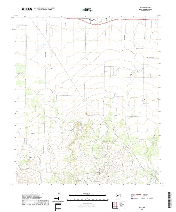
2022 Map of Wall
USGS Topo · Published 2022About this map
Wall serves as the primary community anchor in this part of Tom Green County, situated along the northern edge of the map. The settlement’s local history is anchored by the proximity of Saint Ambrose Cem and Wall Cem, which sit just east of the main town area. The landscape is defined by the drainage patterns of Ninemile Cr in the west and Dry Lipan Cr in the east, which eventually leads toward Lipan Spring. The road network reflects the region’s economic foundations, featuring several family-named routes and industrial infrastructure like the Marathon Oil Co Rd. South of the town, the terrain rises toward the elevations of Susan Peak Rd, showing a transition from the flatter agricultural and residential areas near the highway to the more varied topography of the Texas interior.
Find a feature on this map
25 named features on this map. Tap any name to fly to it.
Don’t see what you’re looking for? This feature index may not catch every label — zoom into the map to look around manually.
Map Details
Editions of this 2022 Wall Map
This is the sole edition of this map. No revisions or reprints were ever made.
Other maps of this area

1892 · San Angelo
USGS Topo · 1:125,000

1924 · San Angelo 2-c
USGS Topo · 1:48,000

1924 · San Angelo 2-b
USGS Topo · 1:48,000

1928 · Wall
USGS Topo · 1:62,500

1954 · San Angelo
USGS Topo · 1:250,000

1957 · Eola
USGS Topo · 1:62,500
1957 · San Angelo South
USGS Topo · 1:24,000

1957 · Wall
USGS Topo · 1:62,500

1958 · San Angelo
USGS Topo · 1:250,000

1965 · San Angelo
USGS Topo · 1:250,000