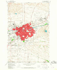
1966 Map of Walla Walla
USGS Topo · Published 1968About this map
Walla Walla serves as the focal point of this mid-1960s study, revealing a dense urban core flanked by agricultural expansion and military history. The city is bordered by the State Penitentiary to the northwest and the expansive Fort Walla Walla Park to the southwest, while Whitman College and the County Courthouse anchor the central district. A complex network of waterways, including Mill Creek and Garrison Creek, underscores the valley's irrigation and drainage patterns, with the Mill Creek Reservoir situated to the east for water management.
Find a feature on this map
64 named features on this map. Tap any name to fly to it.
Don’t see what you’re looking for? This feature index may not catch every label — zoom into the map to look around manually.
Map Details
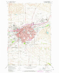
Editions of this 1966 Walla Walla Map
2 editions found
Other maps of this area

1919 · Walla Walla
USGS Topo · 1:125,000

1921 · Walla Walla
USGS Topo · 1:125,000

1953 · Pendleton
USGS Topo · 1:250,000

1953 · Walla Walla
USGS Topo · 1:250,000

1956 · Pendleton
USGS Topo · 1:250,000

1958 · Walla Walla
USGS Topo · 1:250,000

1963 · Peterson Ridge
USGS Topo · 1:24,000

1964 · Milton-Freewater
USGS Topo · 1:24,000

1964 · Bowlus Hill
USGS Topo · 1:24,000

1966 · Dixie
USGS Topo · 1:24,000