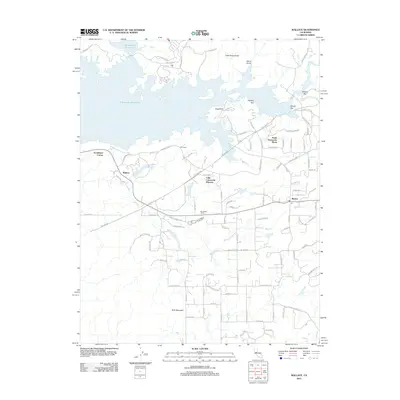
2012 Map of Wallace
USGS Topo · Published 2012About this map
Camanche Reservoir dominates the northern landscape of this Calaveras County region, its sprawling shoreline punctuated by residential developments and legacy landmarks. The map illustrates a shift from traditional ranching toward planned communities, with Lake Camanche Ranches and South Camanche Shore establishing a modern footprint near the water. Historic transit points and rural centers like Wallace and Burson serve as anchors along the roadway network, while Rocabella Ranch reflects the area's agricultural roots.
Find a feature on this map
94 named features on this map. Tap any name to fly to it.
Don’t see what you’re looking for? This feature index may not catch every label — zoom into the map to look around manually.
Map Details
Editions of this 2012 Wallace Map
This is the sole edition of this map. No revisions or reprints were ever made.
Other maps of this area

1889 · Jackson
USGS Topo · 1:125,000

1892 · Jackson
USGS Topo · 1:125,000

1894 · Lodi
USGS Topo · 1:125,000

1897 · Jackson
USGS Topo · 1:125,000

1902 · Jackson
USGS Topo · 1:125,000

1908 · Linden
USGS Topo · 1:31,680

1909 · Goose Creek
USGS Topo · 1:31,680

1909 · Clements
USGS Topo · 1:31,680
1939 · Bellota
USGS Topo · 1:62,500

1941 · Sutter Creek
USGS Topo · 1:62,500