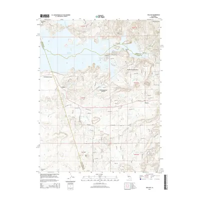
2015 Map of Wallace
USGS Topo · Published 2015About this map
The Camanche Reservoir dominates this landscape on the border of Calaveras, Amador, and San Joaquin counties, where the foothills meet the Sacramento Valley. The map details the residential expansion near the water, particularly at Lake Camanche Ranches and South Camanche Shore, showing a complex network of modern roads like Stedman Ranch Rd and Camanche Rd that have replaced older rural patterns.
Find a feature on this map
108 named features on this map. Tap any name to fly to it.
Don’t see what you’re looking for? This feature index may not catch every label — zoom into the map to look around manually.
Map Details
Editions of this 2015 Wallace Map
This is the sole edition of this map. No revisions or reprints were ever made.
Other maps of this area

1889 · Jackson
USGS Topo · 1:125,000

1892 · Jackson
USGS Topo · 1:125,000

1894 · Lodi
USGS Topo · 1:125,000

1897 · Jackson
USGS Topo · 1:125,000

1902 · Jackson
USGS Topo · 1:125,000

1908 · Linden
USGS Topo · 1:31,680

1909 · Goose Creek
USGS Topo · 1:31,680

1909 · Clements
USGS Topo · 1:31,680
1939 · Bellota
USGS Topo · 1:62,500

1941 · Sutter Creek
USGS Topo · 1:62,500