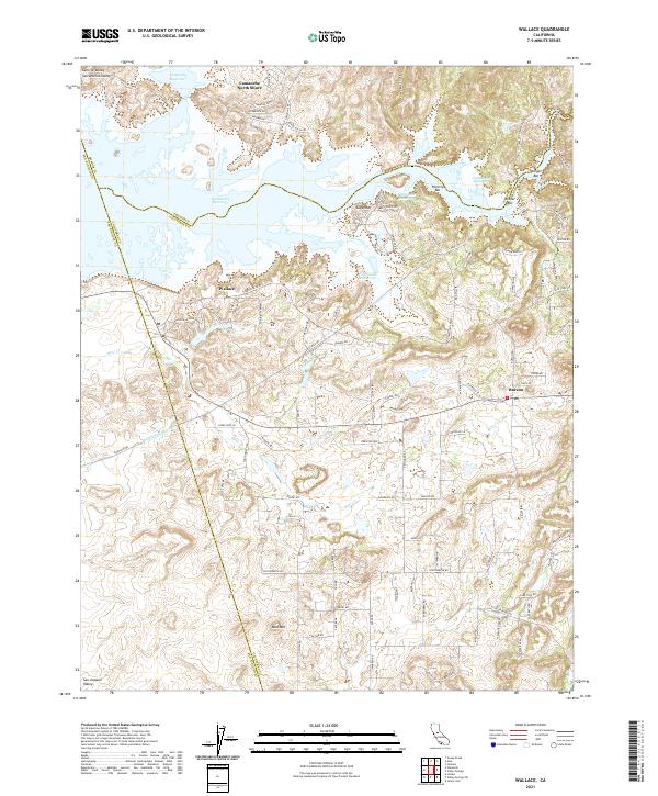
2021 Map of Wallace
USGS Topo · Published 2021About this map
Camanche Reservoir dominates the northern landscape of this Calaveras County survey, where the waters submerge several historical mining bars including Poverty Bar, Oregon Bar, and Winter Bar. The topography transitions from the low reaches of the Sacramento Valley and Central Valley into the foothills of the Sierra Nevada. Small residential communities like Wallace and Burson are detailed alongside established infrastructure such as the Mokelumne Aqueduct. To the north, Camanche North Shore provides a look at the developed recreation and housing surrounding the lake. The terrain is further defined by prominent local landmarks like Bald Mtn and Sugarloaf, as well as drainage systems like China Gulch and Little China Gulch that feed into the reservoir basin.
Find a feature on this map
98 named features on this map. Tap any name to fly to it.
Don’t see what you’re looking for? This feature index may not catch every label — zoom into the map to look around manually.
Map Details
Editions of this 2021 Wallace Map
This is the sole edition of this map. No revisions or reprints were ever made.
Other maps of this area

1889 · Jackson
USGS Topo · 1:125,000

1892 · Jackson
USGS Topo · 1:125,000

1894 · Lodi
USGS Topo · 1:125,000

1897 · Jackson
USGS Topo · 1:125,000

1902 · Jackson
USGS Topo · 1:125,000

1908 · Linden
USGS Topo · 1:31,680

1909 · Goose Creek
USGS Topo · 1:31,680

1909 · Clements
USGS Topo · 1:31,680
1939 · Bellota
USGS Topo · 1:62,500

1941 · Sutter Creek
USGS Topo · 1:62,500