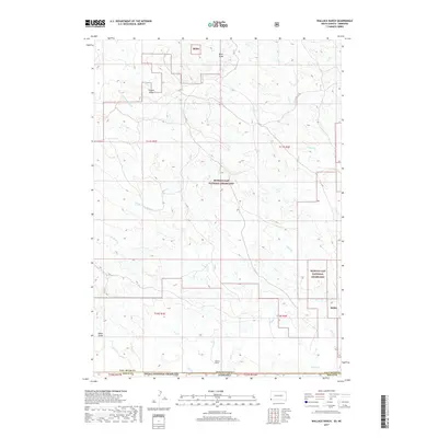
2017 Map of Wallace Ranch
USGS Topo · Published 2017About this map
Wallace Ranch serves as the primary human landmark in this section of the High Plains, situated near the intersection of the South Dakota Nebraska border and the boundary between Fall River Co and Sioux Co. The landscape is dominated by the sprawling protected territories of the Buffalo Gap National Grassland and Oglala National Grassland. The terrain is defined by an intricate network of drainage systems, including the Middle Fork Alkali Cr and Indian Cr, which carve through the plains to form distinctive landforms like Black Gulch, Coyote Draw, and Buck Draw. These seasonal watercourses and draws provide the essential topography for ranching operations in this arid environment, illustrating the traditional land use patterns where habitation is sparse and tied directly to the available water and grazing land found within the national grassland system.
Find a feature on this map
26 named features on this map. Tap any name to fly to it.
Don’t see what you’re looking for? This feature index may not catch every label — zoom into the map to look around manually.
Map Details
Editions of this 2017 Wallace Ranch Map
This is the sole edition of this map. No revisions or reprints were ever made.
Other maps of this area

1902 · Edgemont
USGS Topo · 1:125,000

1954 · Torrington
USGS Topo · 1:250,000

1955 · Hot Springs
USGS Topo · 1:250,000

1955 · Newcastle
USGS Topo · 1:250,000

1955 · Alliance
USGS Topo · 1:250,000

1957 · Alliance
USGS Topo · 1:250,000

1958 · Torrington
USGS Topo · 1:250,000

1958 · Alliance
USGS Topo · 1:250,000

1958 · Newcastle
USGS Topo · 1:250,000

1978 · Coffee Flats
USGS Topo · 1:24,000