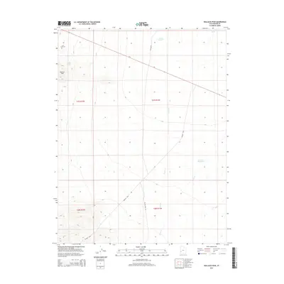
2014 Map of Wallaces Peak
USGS Topo · Published 2014About this map
Wallaces Peak rises above the arid stretches of Beaver County, marking a landscape defined by seasonal water systems and sparse human impact. In the northwest corner, the Squire Family Cem remains a quiet marker of early family history near Wah Wah Springs. The movement of water through this high desert environment is traced through Quartz Cr, Willow Cr, and the broader drainage of the Revenue Basin. Human intervention in this hydrology is visible at the Wah Wah Reservoir and Wintech Reservoir, which manage the occasional runoff of the Wah-Wah Wash. Transportation through this territory is anchored by Ut-21, which cuts across the northern flats, supported by unpaved routes like N Wah Wah Rd and Willow Creek Rd that navigate the basins and foothills.
Find a feature on this map
16 named features on this map. Tap any name to fly to it.
Don’t see what you’re looking for? This feature index may not catch every label — zoom into the map to look around manually.
Map Details
Editions of this 2014 Wallaces Peak Map
This is the sole edition of this map. No revisions or reprints were ever made.
Other maps of this area

1953 · Richfield
USGS Topo · 1:250,000

1958 · Richfield
USGS Topo · 1:250,000

1959 · Frisco
USGS Topo · 1:62,500

1960 · Frisco Peak
USGS Topo · 1:62,500

1960 · Wah Wah Summit
USGS Topo · 1:62,500

1971 · Sewing Machine Pass
USGS Topo · 1:24,000

1971 · Lamerdorf Peak
USGS Topo · 1:24,000

1980 · Wah Wah Mts. South
USGS Topo · 1:100,000

1980 · Wah Wah Mts. North
USGS Topo · 1:100,000
1989 · Frisco Peak
USGS Topo · 1:24,000