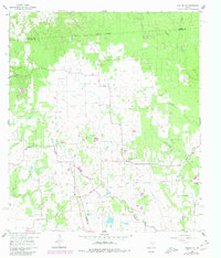
1960 Map of Waller NW
USGS Topo · Published 1980About this map
Spring Creek and its many tributaries, including Threemile Creek and Ponds Creek, carve a dense network of drainages across this coastal plain landscape. The 1960 field-checked survey reveals a rural society centered around small community hubs like Rosehill Com and Reid Prairie Ch. The presence of a Landing Strip and multiple pipelines crossing the Waller and Harris County line reflects the gradual modernization of the Texas interior during the mid-20th century. Local heritage is deeply rooted in the numerous small congregations and meeting places that dot the terrain, from the Community Hall to Good Hope Ch and the secluded Kirby Chapel Cem. The map also captures early industrial markers such as a Gravel Pit and scattered oil wells, signifying the transition from purely agricultural land use to resource extraction.
Find a feature on this map
27 named features on this map. Tap any name to fly to it.
Don’t see what you’re looking for? This feature index may not catch every label — zoom into the map to look around manually.
Map Details
Editions of this 1960 Waller NW Map
2 editions found

Other maps of this area

1914 · Navasota
USGS Topo · 1:62,500

1916 · Hockley
USGS Topo · 1:24,000

1920 · Hockley
USGS Topo · 1:31,680

1920 · Waller
USGS Topo · 1:31,680

1954 · Beaumont
USGS Topo · 1:250,000

1954 · Austin
USGS Topo · 1:250,000

1956 · Hempstead
USGS Topo · 1:62,500

1957 · Beaumont
USGS Topo · 1:250,000

1958 · Courtney
USGS Topo · 1:24,000

1960 · Waller
USGS Topo · 1:24,000