
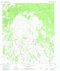
1960 Map of Waller NW
USGS Topo · Published 1962About this map
The rolling prairies and wooded bottoms along the Waller, Harris, and Grimes county lines appear here at the start of the 1960s, a landscape defined by small rural congregations and scattered agriculture. Local social life is anchored by landmarks like the Community Hall and several country churches including Reida Prairie Ch and Good Hope Ch. The drainage of the area is intricate, with Spring Creek and Threemile Creek carving through the terrain, punctuated by numerous small ponds that suggest a reliance on local water sources for livestock.
Find a feature on this map
21 named features on this map. Tap any name to fly to it.
Don’t see what you’re looking for? This feature index may not catch every label — zoom into the map to look around manually.
Map Details
Editions of this 1960 Waller NW Map
2 editions found
Other maps of this area

1914 · Navasota
USGS Topo · 1:62,500

1916 · Hockley
USGS Topo · 1:24,000

1920 · Hockley
USGS Topo · 1:31,680

1920 · Waller
USGS Topo · 1:31,680

1954 · Beaumont
USGS Topo · 1:250,000

1954 · Austin
USGS Topo · 1:250,000

1956 · Hempstead
USGS Topo · 1:62,500

1957 · Beaumont
USGS Topo · 1:250,000

1958 · Courtney
USGS Topo · 1:24,000

1960 · Waller
USGS Topo · 1:24,000