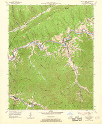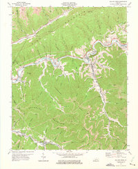
1974 Map of Wallins Creek
USGS Topo · Published 1975About this map
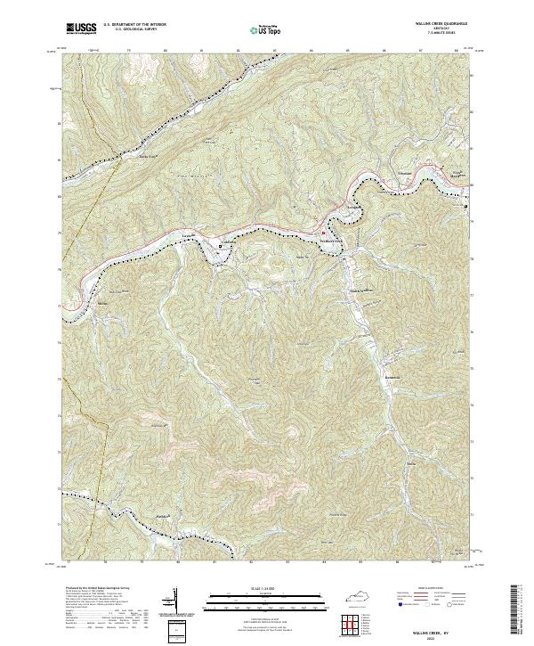
Wallins Creek and the surrounding coal-bearing valleys of Harlan Co are defined by the winding course of the Cumberland River and the industrial backbone of the Louisville and Nashville railroad. Published in the mid-1970s, this survey documents a landscape heavily influenced by extraction, with numerous Strip Mines and a Tipple near Molus. The map captures the tight relationship between topography and settlement, as small communities like Coldiron, Layman, and Tacky Town occupy the narrow habitable spaces between Pine Mountain and Reynolds Mountain. To the south, along the banks of Puckett Creek, the towns of Pathfork and Insull illustrate the era's continued reliance on rail for transporting resources from the heart of the Cumberland Plateau.
Find a feature on this map
93 named features on this map. Tap any name to fly to it.
Don’t see what you’re looking for? This feature index may not catch every label — zoom into the map to look around manually.
Map Details
Editions of this 1974 Wallins Creek Map
This is the sole edition of this map. No revisions or reprints were ever made.
Historical Maps of Wallins Creek Through Time
7 maps found