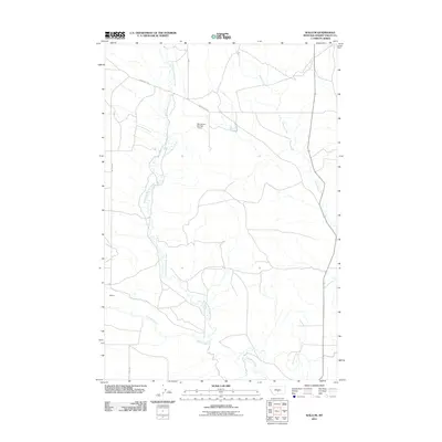
2011 Map of Wallum
USGS Topo · Published 2011About this map
The high plains of Wallum in Golden Valley County are defined by the winding paths of several key drainages in this eastern Montana landscape. Swimming Woman Creek meanders significantly through the center of the area, joined further south by Careless Creek, while Alkali Creek and its southern branch, S Alkali Creek, drain the eastern portion of the sheet. The settlement patterns are Sparse, tied together by a network of rural routes including Hedgesville Rd and Wallum Rd. A singular man-made landmark, the Ray Jerrers Number 1 Dam, suggests the importance of water management for ranching and agriculture in this semi-arid region. This topographic survey captures the quiet infrastructure of the Montana interior, where small family-named lanes like Pirrie Ln and Jessie Rd provide access to the vast open country between the creek beds.
Find a feature on this map
10 named features on this map. Tap any name to fly to it.
Don’t see what you’re looking for? This feature index may not catch every label — zoom into the map to look around manually.
Map Details
Editions of this 2011 Wallum Map
This is the sole edition of this map. No revisions or reprints were ever made.
Other maps of this area

1889 · Big Snowy Mountain
USGS Topo · 1:250,000

1893 · Big Snowy Mountain
USGS Topo · 1:250,000

1954 · Roundup
USGS Topo · 1:250,000

1958 · Roundup
USGS Topo · 1:250,000

1986 · Ryegate West
USGS Topo · 1:24,000
1986 · Ryegate East
USGS Topo · 1:24,000

1986 · Halbert Creek South
USGS Topo · 1:24,000
1986 · Deadmans Basin Reservoir
USGS Topo · 1:24,000

1986 · Halbert Creek North
USGS Topo · 1:24,000

1986 · Wallum
USGS Topo · 1:24,000