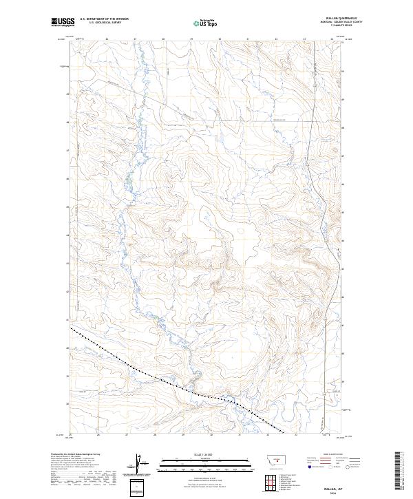
2024 Map of Wallum
USGS Topo · Published 2024About this map
Swimming Woman Creek meanders through this section of Golden Valley County, creating a distinctive drainage pattern across the central plains of Montana. The landscape is defined by its wide open drainage basins, where Alkali Creek and Careless Creek cut through the terrain, establishing the natural boundaries for rural land use. The Public Land Survey System grid organizes the territory, with the junctions of Township 8 North and Ranges 19 and 20 East providing the primary structural framework for the area.
Find a feature on this map
15 named features on this map. Tap any name to fly to it.
Don’t see what you’re looking for? This feature index may not catch every label — zoom into the map to look around manually.
Map Details
Editions of this 2024 Wallum Map
This is the sole edition of this map. No revisions or reprints were ever made.
Other maps of this area

1889 · Big Snowy Mountain
USGS Topo · 1:250,000

1893 · Big Snowy Mountain
USGS Topo · 1:250,000

1954 · Roundup
USGS Topo · 1:250,000

1958 · Roundup
USGS Topo · 1:250,000

1986 · Ryegate West
USGS Topo · 1:24,000
1986 · Ryegate East
USGS Topo · 1:24,000

1986 · Halbert Creek South
USGS Topo · 1:24,000
1986 · Deadmans Basin Reservoir
USGS Topo · 1:24,000

1986 · Halbert Creek North
USGS Topo · 1:24,000

1986 · Wallum
USGS Topo · 1:24,000