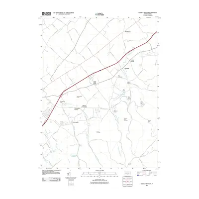
2010 Map of Walnut Bottom
USGS Topo · Published 2010About this map
Yellow Breeches Creek defines the northern reaches of this Cumberland County landscape, winding past the settlements of Walnut Bottom and Brookside. In this early 21st-century survey, the intersection of transport and industry is evident, from the Shippensburg Airport near Cleversburg Junction to the legacy of iron production at Big Pond Furnace. The southern terrain rises toward the ridges of Tobacco Patch Mountain and Long Mountain, sheltering the Chambersburg Reservoir in Reservoir Hollow. Local genealogy is anchored in small, established communities like Lees Cross Roads, Stoughstown, and Cleversburg, which are linked by a dense network of rural roads such as Mud Level Rd and Springfield Rd. The presence of the Big Flat Tower on the southern high ground and the peculiar Cleversburg Sink highlight the area's diverse topographical and utilitarian landmarks.
Find a feature on this map
78 named features on this map. Tap any name to fly to it.
Don’t see what you’re looking for? This feature index may not catch every label — zoom into the map to look around manually.
Map Details
Editions of this 2010 Walnut Bottom Map
This is the sole edition of this map. No revisions or reprints were ever made.
Other maps of this area

1902 · Chambersburg
USGS Topo · 1:62,500

1909 · Fairfield
USGS Topo · 1:62,500

1919 · Newville
USGS Topo · 1:62,500

1923 · Shippensburg
USGS Topo · 1:62,500

1942 · Hagerstown
USGS Topo · 1:125,000

1942 · Gettysburg
USGS Topo · 1:125,000

1943 · Hagerstown
USGS Topo · 1:125,000

1943 · Chambersburg
USGS Topo · 1:62,500

1943 · Shippensburg
USGS Topo · 1:62,500

1944 · Scotland
USGS Topo · 1:31,680
Featured Places
- Shippensburg, PA
- West Pennsboro Township, PA
- North Newton Township, PA
- Southampton Township, PA
- New Lancaster, South Newton Township