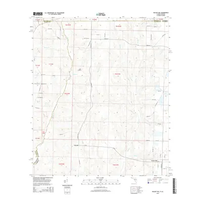
2015 Map of Walnut Hill
USGS Topo · Published 2015About this map
The Perdido River defines the western edge of this landscape, carving a meandering boundary between Baldwin and Escambia counties as it flows south toward the Gulf. This area represents a critical borderland where Alabama and Florida meet, centered on the rural settlements of Pineville and Walnut Hill. The terrain is characterized by a dense network of creek drainages, including Brushy Cr and Hubbard Cr, which feed into the primary river system. Local history is anchored by sites like Halls Fork Cem and Dutch Cem, while the road network reflects long-standing family and geographic markers such as N Pineville Rd and Nokomis Rd. Significant topographic features like Long Hollow punctuate the landscape, illustrating the varied elevation that defines this section of the coastal plain near the state line.
Find a feature on this map
68 named features on this map. Tap any name to fly to it.
Don’t see what you’re looking for? This feature index may not catch every label — zoom into the map to look around manually.
Map Details
Editions of this 2015 Walnut Hill Map
This is the sole edition of this map. No revisions or reprints were ever made.
Other maps of this area

1941 · Century
USGS Topo · 1:62,500

1942 · Perdido
USGS Topo · 1:62,500

1942 · Dyas
USGS Topo · 1:62,500

1943 · Century
USGS Topo · 1:62,500

1944 · Dyas
USGS Topo · 1:62,500

1944 · Perdido
USGS Topo · 1:62,500

1953 · Andalusia
USGS Topo · 1:250,000

1957 · Andalusia
USGS Topo · 1:250,000

1957 · Pensacola
USGS Topo · 1:250,000

1959 · Pensacola
USGS Topo · 1:250,000