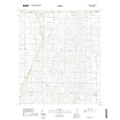
2021 Map of Walnut Hill
USGS Topo · Published 2021About this map
The Perdido River forms a winding natural boundary between Alabama and Florida, anchoring a landscape where agricultural lands meet dense riparian networks. This modern survey detail shows the convergence of Escambia and Baldwin counties, centered on the historic settlements of Pineville and Walnut Hill. The terrain is defined by a series of south-flowing drainages, including Freeman Springs Branch and Hubbard Creek, which have shaped the local topography through features like Long Hollow. Genealogists and local historians will find value in the precise location of family-named sites and landmarks such as Halls Fork Cem and Dutch Cem. The northern edge of the map reaches the outskirts of Atmore, illustrating how regional road networks like Arthur Brown Rd and Co Rd 99 connect these rural communities across state lines.
Find a feature on this map
77 named features on this map. Tap any name to fly to it.
Don’t see what you’re looking for? This feature index may not catch every label — zoom into the map to look around manually.
Map Details
Editions of this 2021 Walnut Hill Map
This is the sole edition of this map. No revisions or reprints were ever made.
Other maps of this area

1941 · Century
USGS Topo · 1:62,500

1942 · Perdido
USGS Topo · 1:62,500

1942 · Dyas
USGS Topo · 1:62,500

1943 · Century
USGS Topo · 1:62,500

1944 · Dyas
USGS Topo · 1:62,500

1944 · Perdido
USGS Topo · 1:62,500

1953 · Andalusia
USGS Topo · 1:250,000

1957 · Andalusia
USGS Topo · 1:250,000

1957 · Pensacola
USGS Topo · 1:250,000

1959 · Pensacola
USGS Topo · 1:250,000