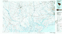
1986 Map of Walterboro
USGS Topo · Published 1986About this map
The Edisto River and its labyrinthine coastal forks define this mid-1980s landscape of the South Carolina Lowcountry. This survey shows the region's complex geography of barrier islands and tidal waterways, from Edisto Island to Johns Island, where the North Edisto River and South Edisto River meet the Atlantic. The interior transitions from managed lands like the Bear Island Game Management Area to historic rural settlements and crossroads, including Catholic Hill and Burnt Church Crossroads.
Find a feature on this map
176 named features on this map. Tap any name to fly to it.
Don’t see what you’re looking for? This feature index may not catch every label — zoom into the map to look around manually.
Map Details
Editions of this 1986 Walterboro Map
This is the sole edition of this map. No revisions or reprints were ever made.
Other maps of this area

1918 · Walterboro
USGS Topo · 1:62,500

1918 · Kiawah Island
USGS Topo · 1:21,120

1918 · Green Pond
USGS Topo · 1:62,500

1918 · Varnville
USGS Topo · 1:62,500

1918 · Yemassee
USGS Topo · 1:62,500

1918 · Cottageville
USGS Topo · 1:62,500

1919 · Ladson
USGS Topo · 1:21,120

1919 · Johns Island
USGS Topo · 1:21,120

1919 · Summerville
USGS Topo · 1:48,000

1919 · Pineland
USGS Topo · 1:62,500