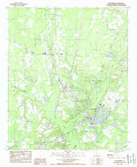
1988 Map of Walterboro
USGS Topo · Published 1988About this map
The county seat of Walterboro serves as the central hub of this South Carolina Lowcountry landscape, where the residential and commercial grid transitions into an intricate network of wetlands and creeks. The hydrology of the region is dominated by the expansive Great Swamp and the Ashepoo River, which anchor the southern portion of the sheet. Outside the main town, smaller named settlements like Stokes, Rhodes Crossroads, and Smokes Corners indicate long-standing rural crossroads and family-named community centers. The terrain is characterized by its slow-moving water systems, including Jones Swamp, Doctors Creek, and Ireland Creek, which weave through the timbered bottoms and agricultural clearings. Cultural landmarks such as the Municipal Airport and the Radio Tower WAFD reflect the late-20th-century infrastructure serving this pocket of Colleton County.
Find a feature on this map
19 named features on this map. Tap any name to fly to it.
Don’t see what you’re looking for? This feature index may not catch every label — zoom into the map to look around manually.
Map Details
Editions of this 1988 Walterboro Map
This is the sole edition of this map. No revisions or reprints were ever made.
Other maps of this area

1918 · Walterboro
USGS Topo · 1:62,500

1919 · Cummings
USGS Topo · 1:62,500

1919 · Lodge
USGS Topo · 1:62,500

1920 · Lodge
USGS Topo · 1:48,000

1920 · St. George
USGS Topo · 1:48,000

1921 · Lodge
USGS Topo · 1:62,500

1921 · St. George
USGS Topo · 1:62,500

1943 · Lodge
USGS Topo · 1:62,500

1943 · Orangeburg
USGS Topo · 1:125,000

1943 · Cummings
USGS Topo · 1:62,500