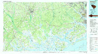
1990 Map of Walterboro
USGS Topo · Published 1990About this map
The Lowcountry river systems and coastal marshes of South Carolina are captured here during the late twentieth century, centered on the inland hub of Walterboro. This landscape is defined by the convergence of major waterways including the Ashepoo River, Combahee River, and Edisto River, which weave through vast wetlands toward the Atlantic Ocean. To the east, the urban expansion of North Charleston and Goose Creek contrasts with the conservation areas of the Bear Island State Game Management Area and Edisto Beach State Park. The map documents a transition from the agricultural and timbered interior to the maritime industry of the coast, noting infrastructure like the Charleston AFB (International Airport) and the US Naval Reservation. Local history is preserved in the location of historic river crossings such as Givhans Ferry and Sullivans Ferry, and small rural communities like Coachmans Corners and Baptist Hill.
Find a feature on this map
238 named features on this map. Tap any name to fly to it.
Don’t see what you’re looking for? This feature index may not catch every label — zoom into the map to look around manually.
Map Details
Editions of this 1990 Walterboro Map
This is the sole edition of this map. No revisions or reprints were ever made.
Other maps of this area

1918 · Walterboro
USGS Topo · 1:62,500

1918 · Kiawah Island
USGS Topo · 1:21,120

1918 · Green Pond
USGS Topo · 1:62,500

1918 · Varnville
USGS Topo · 1:62,500

1918 · Yemassee
USGS Topo · 1:62,500

1918 · Cottageville
USGS Topo · 1:62,500

1919 · Ladson
USGS Topo · 1:21,120

1919 · Johns Island
USGS Topo · 1:21,120

1919 · Summerville
USGS Topo · 1:48,000

1919 · Pineland
USGS Topo · 1:62,500