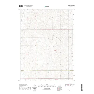
2017 Map of Walthill SW
USGS Topo · Published 2017About this map
The northern reaches of the Thurston Co Burt Co line define this 2017 landscape, where the drainage patterns of several critical waterways carve through the terrain. Flowing through the northern and central sections are S Omaha Cr and S Blackbird Cr, while the northeastern corner is touched by N Blackbird Cr. To the south, the Logan Creek Dredge represents a significant modification of the natural hydrography, typical of regional efforts to manage agricultural drainage. The land is organized by a systematic grid of section lines and rural roads, including Banks Rd and Co Rd W51. This area, primarily agricultural and located within the Omaha Reservation, shows the enduring structure of the Public Land Survey System with townships such as t24n r9e and t25n r8e clearly delineated.
Find a feature on this map
32 named features on this map. Tap any name to fly to it.
Don’t see what you’re looking for? This feature index may not catch every label — zoom into the map to look around manually.
Map Details
Editions of this 2017 Walthill SW Map
This is the sole edition of this map. No revisions or reprints were ever made.
Other maps of this area

1955 · Sioux City
USGS Topo · 1:250,000

1955 · Fremont
USGS Topo · 1:250,000

1957 · Fremont
USGS Topo · 1:250,000

1958 · Sioux City
USGS Topo · 1:250,000

1958 · Fremont
USGS Topo · 1:250,000

1959 · Sioux City
USGS Topo · 1:250,000

1966 · Lyons
USGS Topo · 1:24,000

1966 · West Point NE
USGS Topo · 1:24,000

1966 · Walthill SW
USGS Topo · 1:24,000

1966 · Walthill
USGS Topo · 1:24,000