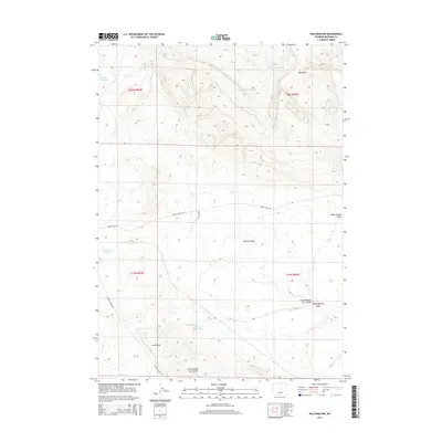
2015 Map of Waltman NW
USGS Topo · Published 2015About this map
Ralston Flats anchors this high-desert landscape in Natrona County, where water management is the primary human imprint on the land. Numerous catchment features like Jackpot Reservoir, Bad Water Cr Reservoir, and the aptly named Dry Hole Reservoir suggest a reliance on seasonal runoff to sustain the area. The terrain is deeply incised by drainage systems such as Dean Springs Draw and the various branches of Cave Gulch, including the North Branch and South Branch. Remote access is maintained through a network of unpaved tracks, most notably Baker Cabin Rd and Buffalo Creek Rd, which traverse the high-elevation flats. These roads, along with Old Dump Rd, highlight the localized infrastructure of this sparsely populated Wyoming territory at the edge of the Bighorn Basin.
Find a feature on this map
21 named features on this map. Tap any name to fly to it.
Don’t see what you’re looking for? This feature index may not catch every label — zoom into the map to look around manually.
Map Details
Editions of this 2015 Waltman NW Map
This is the sole edition of this map. No revisions or reprints were ever made.
Other maps of this area

1952 · Deadman Butte
USGS Topo · 1:24,000

1952 · Arminto
USGS Topo · 1:24,000

1952 · Waltman NW
USGS Topo · 1:24,000

1952 · Waltman
USGS Topo · 1:24,000

1952 · Hiland
USGS Topo · 1:24,000

1952 · Badwater SE
USGS Topo · 1:24,000

1955 · Arminto
USGS Topo · 1:250,000

1958 · Arminto
USGS Topo · 1:250,000

1962 · Arminto
USGS Topo · 1:250,000
1968 · Notches Dome
USGS Topo · 1:24,000