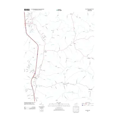
2013 Map of Walton
USGS Topo · Published 2013About this map
The settlement of Crittenden anchors this landscape, positioned along a transportation corridor where the Interstate and major roads follow the high ground between complex drainage systems. To the east, the terrain is defined by the winding tributaries of the Licking River basin, including N Fork Grassy Cr and N Fork Middle Fork Grassy Cr. This area is dense with family-named cemeteries and small crossroads communities such as Bracht, Piner, and Flingsville, illustrating a long-standing pattern of rural residency and ancestry.
Find a feature on this map
124 named features on this map. Tap any name to fly to it.
Don’t see what you’re looking for? This feature index may not catch every label — zoom into the map to look around manually.
Map Details
Editions of this 2013 Walton Map
This is the sole edition of this map. No revisions or reprints were ever made.
Other maps of this area

1929 · Alexandria
USGS Topo · 1:48,000

1930 · Falmouth
USGS Topo · 1:48,000

1936 · Alexandria
USGS Topo · 1:62,500

1936 · Falmouth
USGS Topo · 1:62,500

1950 · Elliston
USGS Topo · 1:24,000

1950 · Union
USGS Topo · 1:24,000

1950 · Williamstown
USGS Topo · 1:24,000

1950 · Independence
USGS Topo · 1:24,000

1950 · Verona
USGS Topo · 1:24,000

1950 · Walton
USGS Topo · 1:24,000