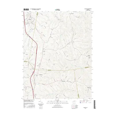
2016 Map of Walton
USGS Topo · Published 2016About this map
Walton and Crittenden anchor the western corridor of this landscape where Boone, Kenton, and Grant counties converge. The terrain is defined by a dense network of creek systems, including Cruises Cr and the North Fork Grassy Creek, which carve through the hills. This 2016 survey documents a rural and residential pattern characterized by numerous family and community burial grounds, such as the Young Cem and Fishback Cem. The distribution of these sites, alongside landmarks like Boone Lake and Leary Lake, reflects a long-standing settlement pattern where small communities like Piner, Bracht, and Fiskburg maintain their distinct identities. Roadways such as Mary Grubbs Hwy and Dixon Rd facilitate travel between these historically significant locales, providing a detailed view of the regional infrastructure as it existed in the mid-2010s.
Find a feature on this map
118 named features on this map. Tap any name to fly to it.
Don’t see what you’re looking for? This feature index may not catch every label — zoom into the map to look around manually.
Map Details
Editions of this 2016 Walton Map
This is the sole edition of this map. No revisions or reprints were ever made.
Other maps of this area

1929 · Alexandria
USGS Topo · 1:48,000

1930 · Falmouth
USGS Topo · 1:48,000

1936 · Alexandria
USGS Topo · 1:62,500

1936 · Falmouth
USGS Topo · 1:62,500

1950 · Elliston
USGS Topo · 1:24,000

1950 · Union
USGS Topo · 1:24,000

1950 · Williamstown
USGS Topo · 1:24,000

1950 · Independence
USGS Topo · 1:24,000

1950 · Verona
USGS Topo · 1:24,000

1950 · Walton
USGS Topo · 1:24,000