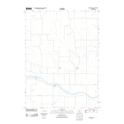
2011 Map of Walworth
USGS Topo · Published 2011About this map
Walworth sits at a geographic crossroads in Custer County, situated near the bend of the Middle Loup River as it winds through the Nebraska sandhills region. This 2011 survey illustrates a sparse ranching and agricultural landscape defined by the drainage patterns of Lillian Creek and Sand Creek, which flow toward the river valley. The settlement pattern is largely dictated by the terrain, with roads like Victoria Springs Rd following the relatively flat river terrace while avoiding the incisions of Winnegar Canyon. For local historians and genealogists, the Walworth Cemetery serves as a primary landmark for the community, providing a fixed point of reference in an area otherwise characterized by large landholdings and open range.
Find a feature on this map
7 named features on this map. Tap any name to fly to it.
Don’t see what you’re looking for? This feature index may not catch every label — zoom into the map to look around manually.
Map Details
Editions of this 2011 Walworth Map
This is the sole edition of this map. No revisions or reprints were ever made.
Other maps of this area

1951 · Lillian
USGS Topo · 1:24,000

1951 · Walworth
USGS Topo · 1:24,000

1951 · Round Valley
USGS Topo · 1:24,000

1951 · Milburn
USGS Topo · 1:24,000

1952 · Sargent West
USGS Topo · 1:24,000

1952 · Almeria SW
USGS Topo · 1:24,000

1952 · Sargent SW
USGS Topo · 1:24,000

1952 · Almeria
USGS Topo · 1:24,000

1952 · Taylor
USGS Topo · 1:24,000

1955 · Broken Bow
USGS Topo · 1:250,000