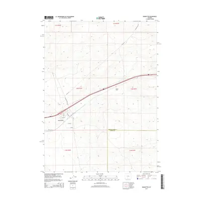
2015 Map of Wamsutter
USGS Topo · Published 2015About this map
Wamsutter serves as the central hub of this high-altitude landscape, where the town’s grid is anchored by streets like Bugas Ave and Tierney St. The area is defined by its critical position along the Continental Divide, influencing the drainage patterns of features like Hansen Draw. The map highlights a complex network of industrial and rural transportation, with Pipeline Rd and Wamsutter Crooks Gap Rd cutting across the terrain to support the region's energy infrastructure. Beyond the town center, the boundary between Sweetwater Co and Carbon Co marks the eastern edge of the quadrangle, while outlying routes such as Latham Rd and Riner Rd extend into the surrounding arid territory, reflecting the sparse but purposeful settlement pattern of the modern Wyoming interior.
Find a feature on this map
15 named features on this map. Tap any name to fly to it.
Don’t see what you’re looking for? This feature index may not catch every label — zoom into the map to look around manually.
Map Details
Editions of this 2015 Wamsutter Map
This is the sole edition of this map. No revisions or reprints were ever made.
Other maps of this area

1954 · Rawlins
USGS Topo · 1:250,000

1954 · Rock Springs
USGS Topo · 1:250,000

1958 · Rawlins
USGS Topo · 1:250,000

1958 · Rock Springs
USGS Topo · 1:250,000

1960 · Lost Creek Butte
USGS Topo · 1:62,500

1962 · Rawlins
USGS Topo · 1:250,000

1962 · Rock Springs
USGS Topo · 1:250,000

1966 · Wamsutter
USGS Topo · 1:24,000

1966 · Monument Lake
USGS Topo · 1:24,000

1966 · Creston
USGS Topo · 1:24,000