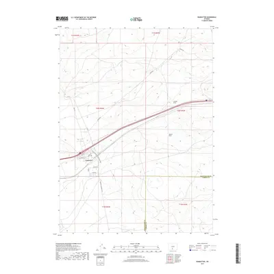
2017 Map of Wamsutter
USGS Topo · Published 2017About this map
Wamsutter stands as a focal point of infrastructure and transport in this high desert landscape, positioned along the major corridor that traverses the southern reaches of the state. The town's grid is detailed with local streets such as Murray Ave, Bugas Ave, and Tipton St, reflecting the concentrated footprint of this crossroads community. North and south of the settlement, the terrain is defined by wide drainages including Latham Draw and Hansen Draw, which cut through the open land in an area increasingly shaped by energy infrastructure, as evidenced by the prominence of Pipeline Rd.
Find a feature on this map
20 named features on this map. Tap any name to fly to it.
Don’t see what you’re looking for? This feature index may not catch every label — zoom into the map to look around manually.
Map Details
Editions of this 2017 Wamsutter Map
This is the sole edition of this map. No revisions or reprints were ever made.
Other maps of this area

1954 · Rawlins
USGS Topo · 1:250,000

1954 · Rock Springs
USGS Topo · 1:250,000

1958 · Rawlins
USGS Topo · 1:250,000

1958 · Rock Springs
USGS Topo · 1:250,000

1960 · Lost Creek Butte
USGS Topo · 1:62,500

1962 · Rawlins
USGS Topo · 1:250,000

1962 · Rock Springs
USGS Topo · 1:250,000

1966 · Wamsutter
USGS Topo · 1:24,000

1966 · Monument Lake
USGS Topo · 1:24,000

1966 · Creston
USGS Topo · 1:24,000